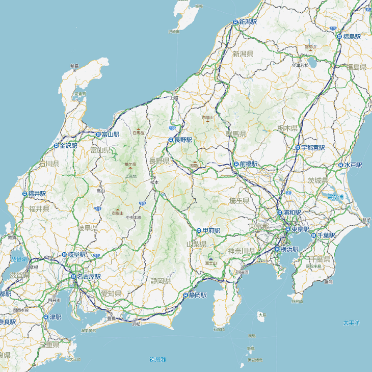
Have you ever been to Japan? Do you know the Japanese road system? Even if you have not yet visited the densely populated and fascinating island nation in the Pacific, you are probably familiar with pictures and videos showing the vast sea of roads in Tokyo, Osaka or Yokohama. But the road and traffic system in Japan is also recognized for its safety, organization, and efficiency, contributing to smooth daily commutes and an overall high standard of transportation.
At this year’s NDS Conference, participants were able to learn more about the Japanese road system from the perspective of a navigation expert. Kevin Anthony Chen, Sales Manager at ZENRIN Europe GmbH, gave exciting insights into the NDS database for Japan. ZENRIN has been part of the NDS consortium for many years and is able to provide map databases in the current NDS formats NDS.Classic and NDS.Live.

ZENRIN at a glance
As a leading Japan map data provider, ZENRIN is focused on the development of cutting-edge digital maps tailored for car navigation systems. Their diverse offerings encompass standard-definition maps (SD), high-definition maps (HD), and 3D maps, customized to the evolving needs of navigation technology. Beyond automotive applications, ZENRIN’s services extend to GIS solutions, Point of Interest (POI) data, location-based services for ad tech, a sky network designed for drones, and mapping solutions for businesses and government entities.
ZENRIN’s expertise in map creation has proven successful across various industries. The company made significant contributions to fleet management, city planning, logistics, real estate, location-based marketing, emergency services, and governmental initiatives.
ZENRIN Japan Map
Renowned for its excellence, ZENRIN’s Japan map data is widely utilized in automotive and Internet of Things (IoT) applications. It plays a vital role in enhancing driving experiences, facilitating route planning, supporting Advanced Driver Assistance Systems (ADAS), providing visual representations, and enabling efficient searches.
ZENRIN’s SD Japan map consist of three main parts: Road geometry and building footprints for display purposes, road network and pedestrian network for route calculation purposes, and POI and address data for destination search purposes. The nationwide road network is classified into multiple levels based on road type for route calculation as well as display purposes. ZENRIN POI contains information for category, address, phone number, business hour, regular holiday, parking availability and much more. It is structured in units of 47 prefectures.
Map Creation Process
The map creation process at ZENRIN can be separated into three phases: collection, maintenance and creation. Through periodic field survey, the ZENRIN team continuously maintains detailed and comprehensive map data tailored to various needs, from maps designed for humans to maps for machines such as autonomous vehicles. On-site walking and vehicle surveys help ensure data freshness, accuracy, and comprehensiveness. ZENRIN operates over 70 survey bases across Japan, where dedicated staff actively collect fresh data by walking the streets. Additionally, ZENRIN deploys survey vehicles equipped with advanced Lidar technology to generate high-precision 3D data.
For maintenance, the company is using aerial image to enhance accuracy and to correct positions. ZENRIN also cooperates with taxi companies in Japan to utilize their dashcam footage data for additional data freshness. Systems running 24 hours a day help to monitor changes.
For its vehicle network ZENRIN has around two million kilometers of data and for its pedestrian network there is approximately 1.8 million kilometers. Additionally, there are millions of records for traffic lights, building arrival points (entrances to buildings), regulation signposts and many more. Furthermore, there are specific HD, XD and SKYMAPS the developers at ZENRIN have been working on over the past years – and will be developing further in the future.
ZENRIN maps in NDS
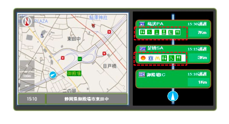
ZENRIN compiles and uses its Japan specific content in the NDS format – first NDS.Classic, but NDS.Live soon to come. First there is the Japan-specific expressway related content: This so called “Highway Mode” or “Expressway Mode” displays information about upcoming rest areas, junctions, interchanges etc. on the expressway in a consolidated view. In Japan, POIs in a particular location are also displayed in “Highway Mode”.
Since there are no existing attributes for this purpose available in NDS yet, the developers at ZENRIN created a special category for “Highway Mode” in the POI building block. Locations where the expressway branches off and the location of the rest area are registered as POIs. By using this information, developers can achieve similar functions in their applications.
Another aspect Kevin talked about at NDS conference was ZENRIN’s Toll Fee Calculation, an ongoing topic for the developers. Since Japan’s toll system is quite complex, there are still some hurdles yet to overcome. Depending on the area there sometimes are flat fee rates and sometimes there are distance-based rates. Furthermore, the rate changes depending on vehicle type and ETC discounts. These are based on the time, day of the week, route taken etc. Due to the special discounts, the following irregular cases (issues) remain when compiling toll fee data in NDS:
Then there is also Japan specific address content. Japanese addresses are not associated to any streets, but have a hierarchical structure that goes from largest geographical area to smallest and consists of the seven levels prefecture, municipality, district, sub-district, block, house number and sub-number. But not all addresses have seven levels. To compile these specific aspects in NDS, the developers use dummy data and no value in the SLI.
From NDS.Classic 2.4.6, storing Addresses_Point at the lowest level of an address has become mandatory. Therefore, addresses from level 5 (block) onwards are stored in the “HOUSEnumber” of the “RoutingAuxTileTable”. And since the ZENRIN address data contains “Building Arrival Point” for every address in Japan, this info can be useful here, too.
In addition, ZENRIN also uses EV charging station data and real-time availability information. Detailed data of EV charging stations nationwide is stored as POIATTR under the category of EV stands in POI. Examples of attributes that are not defined in NDS and that are therefore stored as text or as additional attribute are fees, regular closing days, user restriction, special remarks etc. making searching or filtering difficult. “This is a topic we’d like to discuss and find a solution for in the future”, says Kevin Anthony Chen. Furthermore, ZENRIN has recently added a real-time availability API service to be incorporated into NDS: For every EV charging station in Japan there is a unique ID in NDS so that when real-time information is received, the system will know where to match it.
The future concept ZENRIN is working on right now is the so-called SD-ADAS Intersection Polygon, a concept they would like to transfer into the NDS format as well.
To learn more about NDS.Live, please visit the NDS.Live Developer Portal.
Back to news →