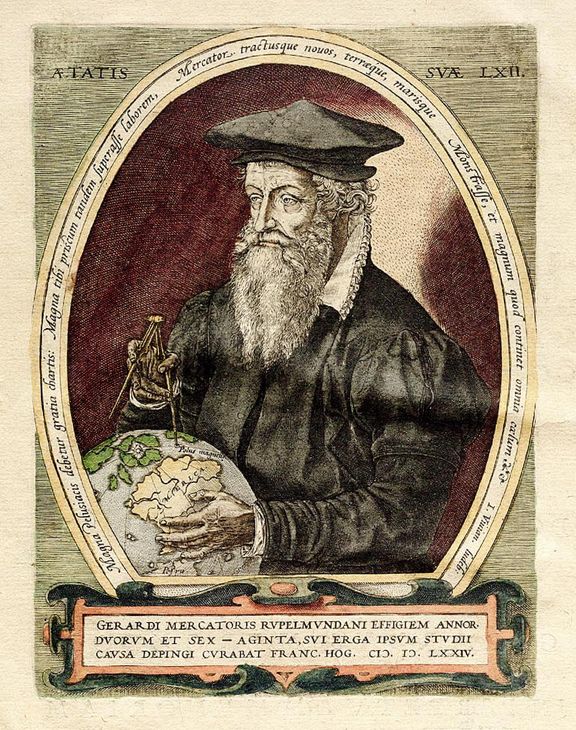
The history of navigation is characterized by numerous great thinkers and pioneers, cartographers, and discoverers. Ptolemy’s view of the world shaped the image of the world for many centuries like no other: around 150 AD, he held the view that the Earth was a sphere and at the same time placed the Earth at the center of the universe. The authoritative world map, however, was that of Gerhard Mercator from 1569. It is the first world map that is true to the angle, and nautical charts are still mostly published in the way and manner named after their developer. Would the Navigation Data Standard exist without geographers or cartographers like Mercator? Probably not, because new thinking is the key to innovation and future strength. Reason enough for us to remember Gerhard Mercator these days at the beginning of March: He was born on March 5, 1512, as Gheert Cremer in the county of Flanders (Belgium) and died on December 2, 1594, in Duisburg (Germany).
Mercator’s basic idea: It was and is vital for seafarers to have reliable and always accurate map material. At the beginning of the 16th century, this was still a matter of luck, because the maps were not true to angle. That’s why courses could not always be calculated exactly at that time. But Mercator found a reliable method. He succeeded in representing the surface of the globe in such a two-dimensional way that neither latitude nor longitude circles are curved. The map shows symmetrical rectangles throughout. The so-called Mercator projection is still valid today and serves as the basis for navigation – even on roads.
Just as Mercator’s work on the Mercator projection helped to advance the field of navigation by providing a useful tool for plotting courses, the Navigation Data Standard helps to advance the field of navigation by providing a standardized format for navigation data that can be used across different platforms and systems.
The goal of both Mercator’s work and the Navigation Data Standard is to make navigation easier, and more reliable. While the technologies used in navigation and the demands have certainly evolved since Mercator’s time, the underlying goal remains the same: to help people find their way and reach their destinations safely and efficiently.
Today, the tradition of Mercator’s work continues with the development of the Navigation Data Standard. Members of our association are collaborating on the unified NDS standard for map data in automotive ecosystems, which brings a number of benefits to all stakeholders:
Would you like to learn more or are you interested in becoming a member? We look forward to hearing from you!
Back to news →