
A specification is a promise. Sample data is the proof. Four NDS members, HERE, TomTom, ZENRIN, and NNG (together with its regional partners), have opened up slices of their real production maps as free NDS.Live evaluation services. Here is what is inside them, and how to get your hands on the data.
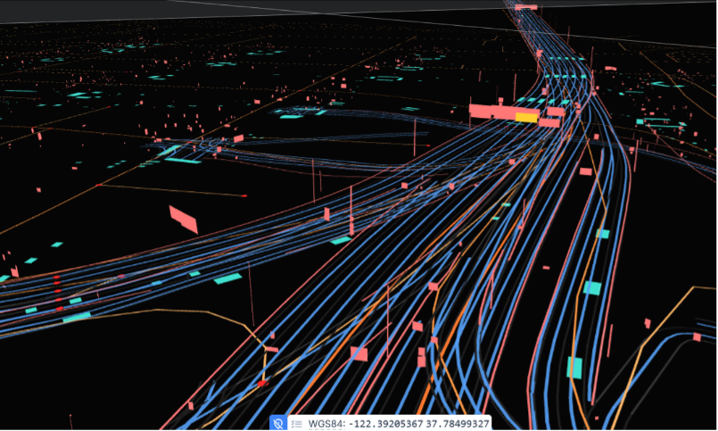
Anyone evaluating a map format eventually hits the same wall. The documentation reads well, the schema looks sound, but until real data has run through your own stack, you do not actually know what you have.
Synthetic test data tells you whether your parser works. It does not tell you what happens when a motorway interchange stacks a dozen lane groups on top of one another, when a point of interest carries EV-charging payment methods and opening hours, or when the same layer type appears five times in a single tile because the supplier chose to keep driving rules, signs, traffic lights, and region rules apart. Those are the details that decide whether an integration takes a week or a quarter.
That is the gap the NDS.Live evaluation services close. They are not marketing renders and not toy geometry. They are extracts of the same production map data these suppliers ship commercially, encoded in NDS.Live and served through the standard Smart Layer Tile API. You point a client at an endpoint and start reading.
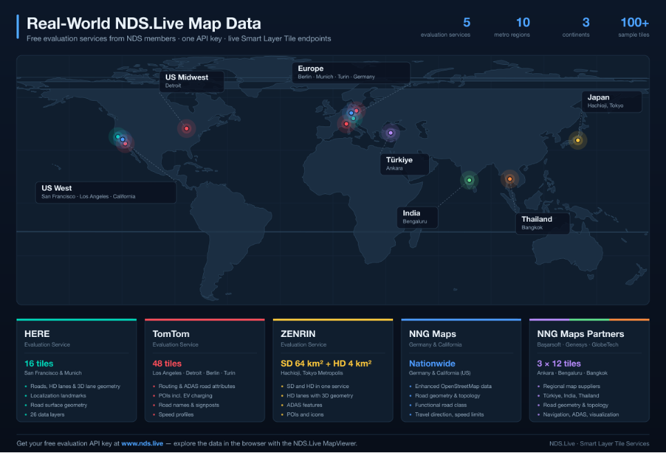
16 tiles · San Francisco and Munich · 26 data layers
The HERE evaluation service is the one to reach for when you want to see how far the NDS.Live data model actually goes. Sixteen real-world tiles across the San Francisco and Munich regions carry roads, lanes and localization landmarks, together with road surface geometry and a deep set of attributes for roads, lanes and road locations.
It is also the clearest demonstration of a modelling technique that surprises most newcomers: the same layer type can appear several times in one tile, each instance filled for a different purpose. In this service the RoadRulesLayer shows up repeatedly, carrying driving rules, signs, traffic lights, and region rules separately rather than crammed together. Twenty-six layers in total, which makes this the most complete worked example of the standard that is publicly available.
48 tiles · Los Angeles, Detroit, Berlin, and Turin
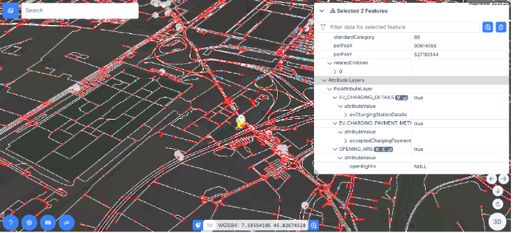
Where HERE goes deep, TomTom goes wide. The TomTom evaluation service ships 48 tiles split evenly across four very different road networks: twelve south of Los Angeles, twelve north-west of Detroit, twelve west of Berlin and twelve west of Turin. If you are building a navigation application and want to know whether it behaves the same on a US grid, a German Autobahn approach and an Italian city fringe, this is the fastest way to find out.
The content is aimed squarely at routing and ADAS use cases: road geometry with the attributes needed for guidance, speed profiles, road names and the administrative hierarchy, signposts, and regional rules. It also carries a full points-of-interest stack: POI geometry, names, attributes, and relations, including EV charging stations with their accepted payment methods.
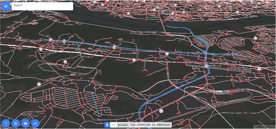
SD across 64 km² · HD across 4 km² · Hachioji, Tokyo Metropolis
The ZENRIN evaluation service covers Hachioji City in the Tokyo Metropolis, and it is unusual in that it delivers standard-definition and high-definition content side by side from one endpoint. SD content spans 64 square kilometres at NDS level 13; HD content covers 4 square kilometres at level 14.
That combination is the interesting part. A single service carries everything from roads, functional road class and speed limits through to HD lanes with 3D geometry, lane-level ADAS features and lane widths, which lets you exercise the whole span of use cases, from simple routing to automated driving, without switching data sources. POIs and display icons round it out.
Germany and California, plus 12 tiles each from Türkiye, India, and Thailand
NNG contributes two things. The first is NNG Maps Germany & California, enhanced OpenStreetMap data covering an entire country, and an entire US state, with road geometry, topology and the key attributes: functional road class, priority road class, road type, travel direction and speed limits. For sheer extent, it is the largest of the evaluation datasets.
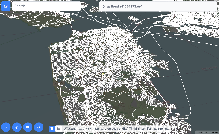
The second is arguably more valuable: three regional map suppliers, brought into NDS.Live through NNG, covering markets that are genuinely difficult to source sample data for.
All four NNG services share the same layer set and module versions, so a client written against one works against the others unchanged, which is rather the point of a standard.
| Service | Regions | Coverage | Highlights |
| HERE | San Francisco, Munich | 16 tiles | 26 layers; HD lanes, localization landmarks, road surface geometry |
| TomTom | Los Angeles, Detroit, Berlin, Turin | 48 tiles | Routing & ADAS attributes, POIs incl. EV charging, signposts, speed profiles |
| ZENRIN | Hachioji, Tokyo Metropolis | SD 64 km² + HD 4 km² | SD and HD from one service; HD lanes, ADAS, POIs, icons |
| NNG Maps | Germany, California (US) | Nationwide / statewide | Enhanced OSM; road geometry, topology, FRC, speed limits |
| NNG Maps partners | Ankara, Bengaluru, Bangkok | 3 × 12 tiles | Başarsoft, Genesys, GlobeTech; roads, topology, core attributes |
Every one of these services is a Smart Layer Tile Service. Each publishes an OpenAPI specification at its access URL that describes exactly which endpoints it offers, and each returns the same zserio-encoded NDS.Live structures. The differences are in content and module versions, not in how you talk to them.
There are three practical ways in:
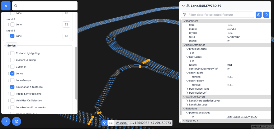
Alongside the real-world services, NDS publishes a set of artificially generated sample maps called the NDS Islands. They are deliberately tiny and deliberately focused, each one isolating a single feature of the data model: a motorway, an intersection, lane markings, a tiled highway, a tiled intersection, lane attributes, a parking facility, and a 3D display map of Berlin.
Crucially, the Islands are freely accessible to everyone with no terms to accept and no application to fill in. They are the ideal first target for a new client implementation: small enough to read end to end, and available both as live services and as static files with YAML alongside the binaries, so you can compare what you parsed against a textual representation of the same tile. Open them straight away at viewer.nds.live.
The evaluation services are free. All they ask is that you accept each supplier’s terms of use, which takes about a minute.