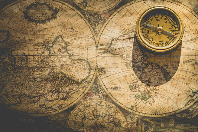
Our desire to depict the world around us dates back to the Stone Age. Early humans painted rudimentary maps on the walls of their caves – pictures of the stars or of the world around them. This may sound instinctive to us, but let us take a moment to appreciate what a revolutionary concept maps are.
In a historical context, the development of cartography has essentially happened in slow motion. Mapping was a tedious process: Cartographers needed to be explorers, geographers and inventors at the same time. They created the necessary instruments, physically visited places and took fastidious measurements under challenging circumstances. And this was just half of the work.
To understand that a map cannot be a realistic representation of the actual world is an incredible accomplishment. Instead, each map serves a purpose: Enable readers to navigate a certain area of the world, or show ownership structures, and so on.
To achieve this, the creator of the map has to carefully select which information to include. This could be recognizable landmarks such as rivers or mountains, or abstract information like toponyms (place names) or political boundaries. Maybe even more importantly, it has to be decided which information should be left out: Is a piece of data irrelevant for the purpose of the map? Or is it too short-lived and the map would be obsolete before it is even published?
Nowadays, we live in the era of connectivity and (seemingly) infinite digital data storage. New data transfer possibilities like WiFi or 5G will enable us to share data in real-time and in large quantities. Theoretically, we could create a high-resolution map that includes all information about the world and is always up to date.
Digital maps already include so much more information than their paper cousins. Besides very detailed “classic” map data like roads and landmarks, they can now also incorporate short-lived information like speed limits, roadworks or even fuel prices – thanks to frequent updates over the air.
The challenge lies no longer in selecting map information, but in structuring the masses of information in the map. With the amount of data contained, a digital map simply cannot be used nor updated as a whole like a giant image file – a classic example of Too Much Information. The data has to be portioned into bite-sized chunks that can quickly and easily be digested by in-car systems like navigation or advanced driver assistance (ADAS), and updated over the air.
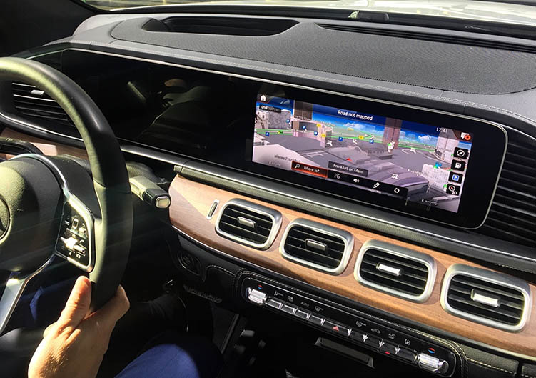
In a nutshell, this is what NDS does: The worldwide standard for map data in automotive eco-systems defines structures for high definition (HD) maps. Its newest version, NDS.Live, is scheduled for release in 2020 and focuses on enabling cloud-connected data, dynamic updates and new vehicle functions like online services and autonomous driving.
With NDS.live, digital map data is basically clustered in three different categories according to its lifespan:
Static data
This includes stable information that rarely changes, e.g. city names, the road network, landmarks or points of interest. Of all three categories, static data resembles our classic paper maps the most. It can be uploaded into the car in big chunks during production and should be updated yearly, for example during maintenance in the car workshop.
Dynamic data
Dynamic data can change frequently, for example lane groups, roadworks or speed limits. This data is updated per tile (small map sections) and streamed into the car with weekly or daily frequency. To minimize data transfer, it is possible to only update relevant sections, e.g. tiles that contain new information or a road corridor for a longer journey.
Live or volatile data
This type of data comes with an expiry date and delivers information about the weather or traffic, about the number of free parking spaces, or the availability of electric vehicle charging stations. It needs to be updated in small nuggets in real-time to be of use to the driver.
These three categories can be broken down further, e.g. according to whether they are generally applicable for all drivers (road network, weather information) or answer a very specific request (points of interest, route information).
And if you look at it this way, the indefinite amount of digital map data doesn’t seem so overwhelming after all. Even short-lived information can now be part of the map, updated frequently and efficiently. The result is a very precise, high-definition representation of the world around us – presumably what already the earliest cartographers dreamt about.
Back to news →